Aerial photography for flower shows, public events and visitor attractions
Planning an outdoor event, flower show or visitor-attraction campaign? View my drone and aerial photography service for coverage, current pricing and flight-planning details. This case study shows how aerial photography supported RHS gardens and events across the UK.
Over the past four years, I have used drone photography to document RHS gardens, flower shows, indoor exhibitions and seasonal Glow events across the UK.
The finished aerial images were created for marketing campaigns, websites and social media, while also helping internal teams understand garden layouts, visitor routes and potential future developments.
Drone photography was never used simply to create a dramatic overhead image. Its real value lay in showing how the gardens, buildings, pathways, installations, and surrounding landscape worked together.
Photographing RHS locations from the air
My aerial work for the RHS has included repeated shoots across:
- RHS Garden Wisley
- RHS Garden Bridgewater
- RHS Garden Hyde Hall
- RHS Garden Rosemoor
- RHS Harlow Carr
- RHS Hampton Court Palace Garden Festival
- The RHS Urban Show at Mayfield Depot
- RHS Badminton Flower Show
Each location required a different approach.
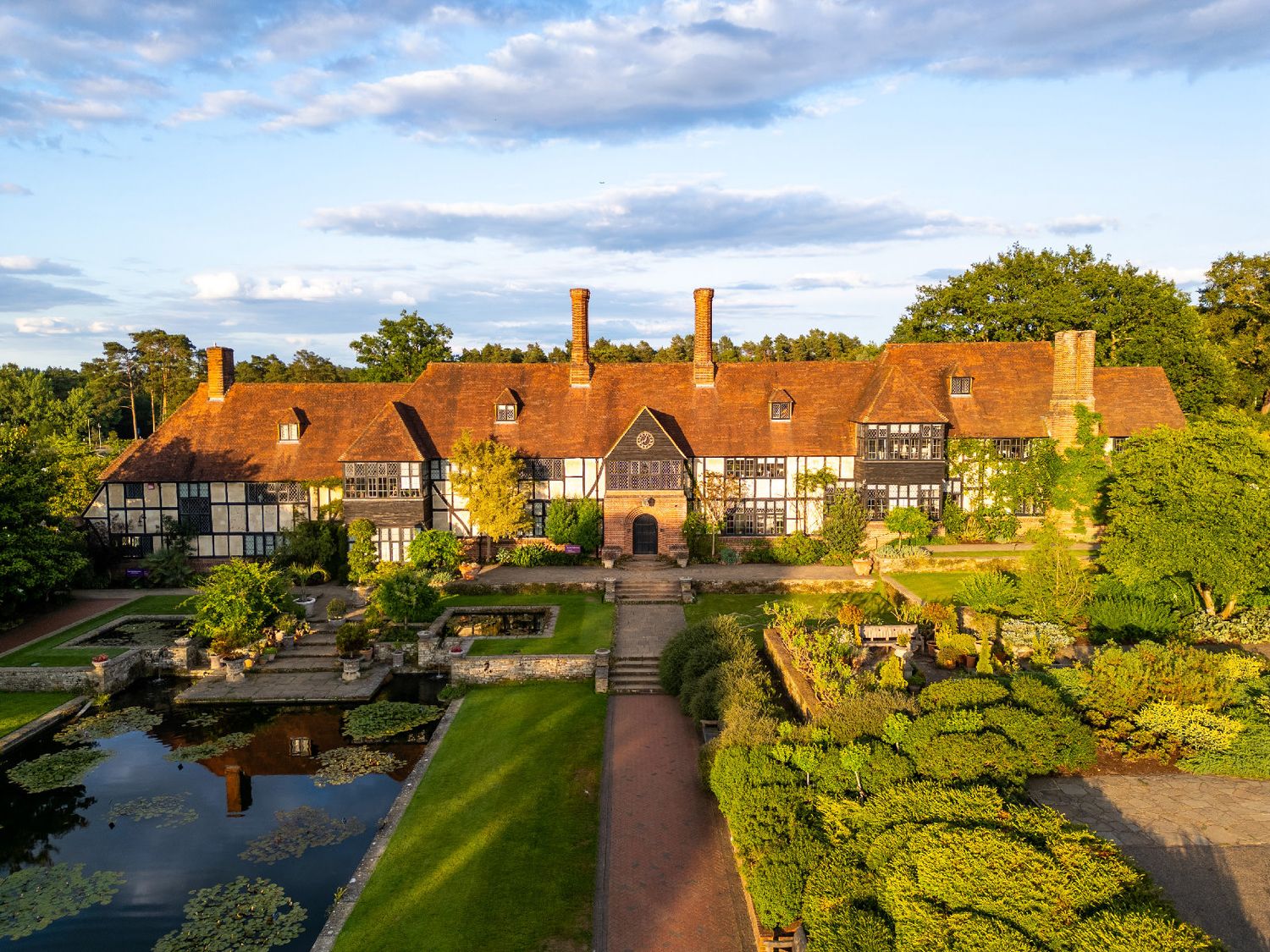
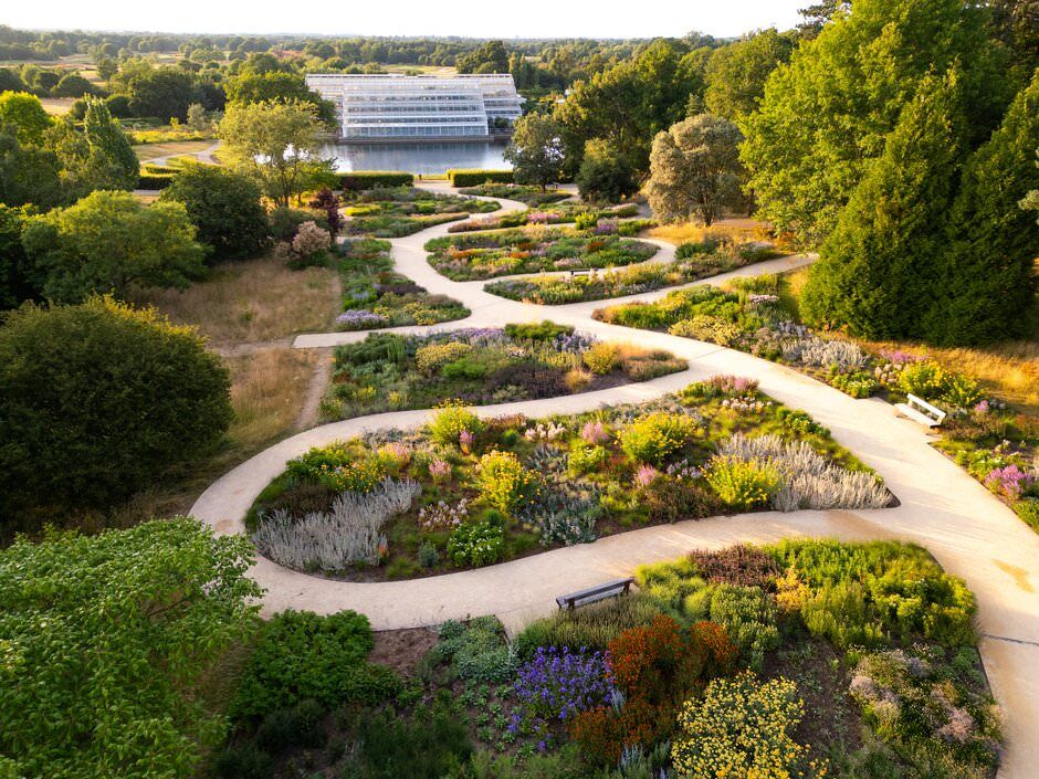
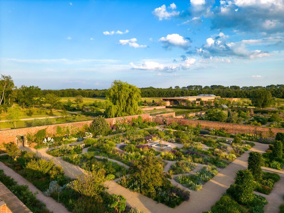
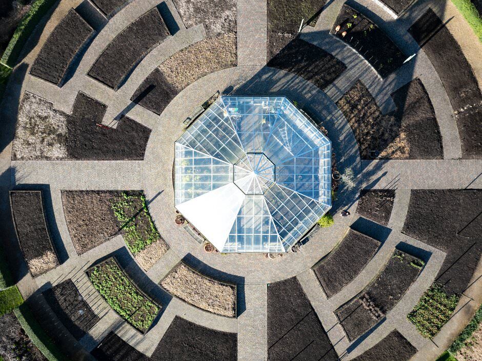
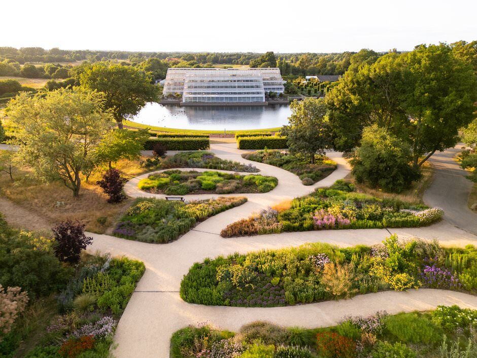
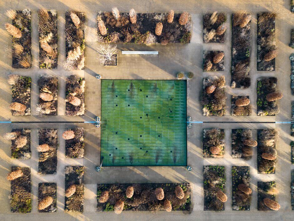
Formal gardens often benefited from carefully composed overhead views that revealed planting patterns, symmetry and pathways. Larger events needed wider photographs showing the relationship between show gardens, exhibitor areas and visitor routes.
Indoor exhibitions and evening light trails presented completely different challenges, but the aim remained the same: to give viewers a clear sense of place that could not be achieved from ground level.
See more examples in my professional drone and aerial photography portfolio.
What does drone photography add to garden marketing?
Ground-level photography is essential for capturing planting details, visitor experiences and individual features. However, it can be difficult to understand the overall shape and scale of a garden from the ground alone.
Aerial photography can show:
- The layout of paths and visitor routes
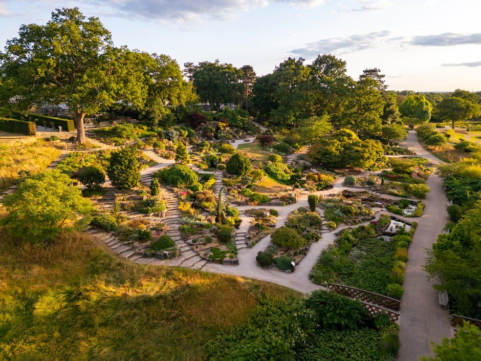
- The scale and structure of a garden
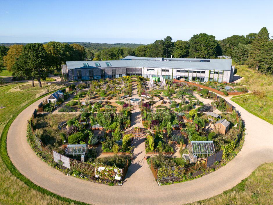
- Relationships between buildings, planting and open spaces
- The position of individual features within the wider landscape
- The overall footprint of a flower show or event
- How a location changes across different seasons
These images were useful for public-facing marketing, but they also had practical internal value. Garden teams could use them when considering future developments, routes and changes to the landscape.
This combination of practical documentation and strong visual storytelling is one reason aerial photography works particularly well for visitor attractions and tourism photography.
Planning safe aerial photography at public gardens
Every flight began with checks of the weather, airspace, and the surrounding area. I used Altitude Angel to review the proposed flight area and confirm whether any airspace restrictions affected the shoot.
The flights covered in this case study did not have restrictions that prevented the planned work, but that did not mean simply arriving and putting the drone in the air.
I planned a rough shot list and flight route before taking off, considering:
- The required photographs
- Visitor numbers
- Nearby buildings and trees
- Take-off and landing areas
- Weather and wind conditions
- Safe distances and flight routes
I operated solo during most shoots, although I occasionally worked with a spotter when the location or activity around the flight made one beneficial.
Where possible, aerial photography was completed before a garden became busy or before large crowds arrived. This reduced disruption and created clearer photographs of the location.
Photographing flower shows from above
A flower show contains far more than the individual show gardens visible from ground level.
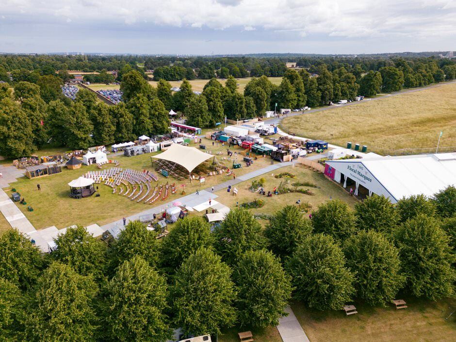
Aerial photography can reveal the complete event layout, including displays, structures, hospitality areas, pathways and the relationship between the showground and its surroundings.
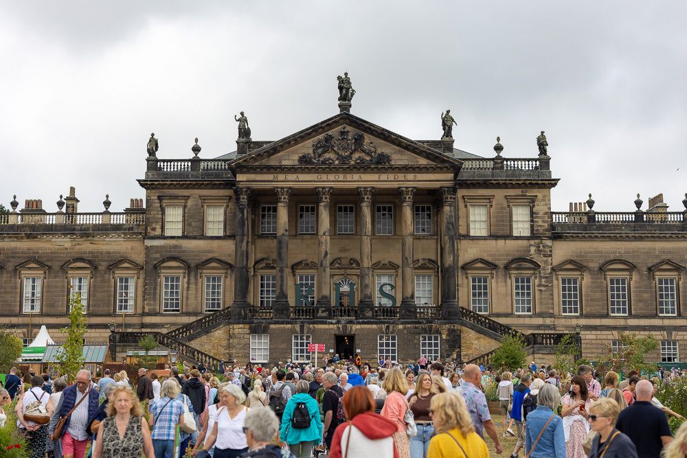
At RHS Hampton Court Palace Garden Festival, the aerial perspective helped communicate the full scale of the show. Wide photographs placed individual features into context, while lower viewpoints highlighted patterns, pathways and carefully designed areas.
These broad establishing images work particularly well alongside conventional event photography, which captures the people, atmosphere, details and activity happening on the ground.
Indoor drone photography at the RHS Urban Show
The RHS Urban Show at Manchester’s Mayfield Depot offered an unusual opportunity to photograph a large indoor exhibition using a drone.
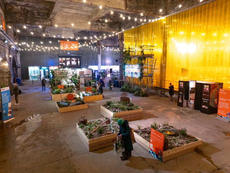
The industrial venue was filled with gardens, planting, displays and installations. From ground level, it was possible to photograph individual areas, but much harder to convey how the entire exhibition fit within the building.
For the indoor flights, I waited until the venue had closed to visitors and the space was much quieter. This gave me greater control over the flight and allowed the drone to be used without disrupting the public.
The resulting images showed the exhibition layout and the contrast between the planting and Mayfield Depot’s industrial structure.
Indoor drone photography is possible in some large venues, but I assess it on a case-by-case basis. The size of the space, obstacles, people, access, and the ability to control the environment all need to be considered before a flight can be agreed upon.
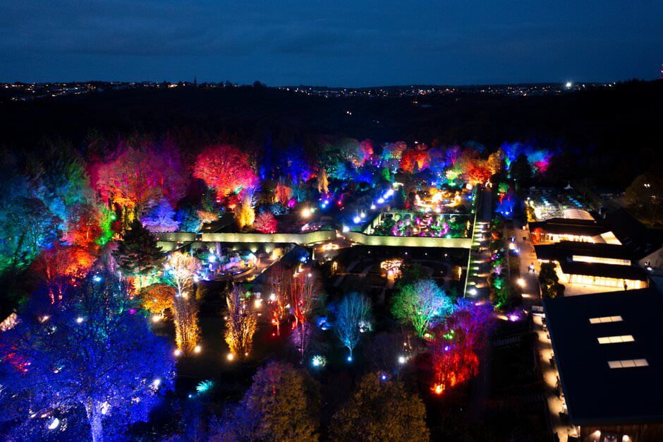
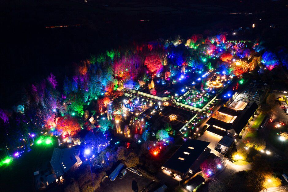
Night-time drone photography at RHS Glow
Drone photography at RHS Glow presented a different technical challenge.
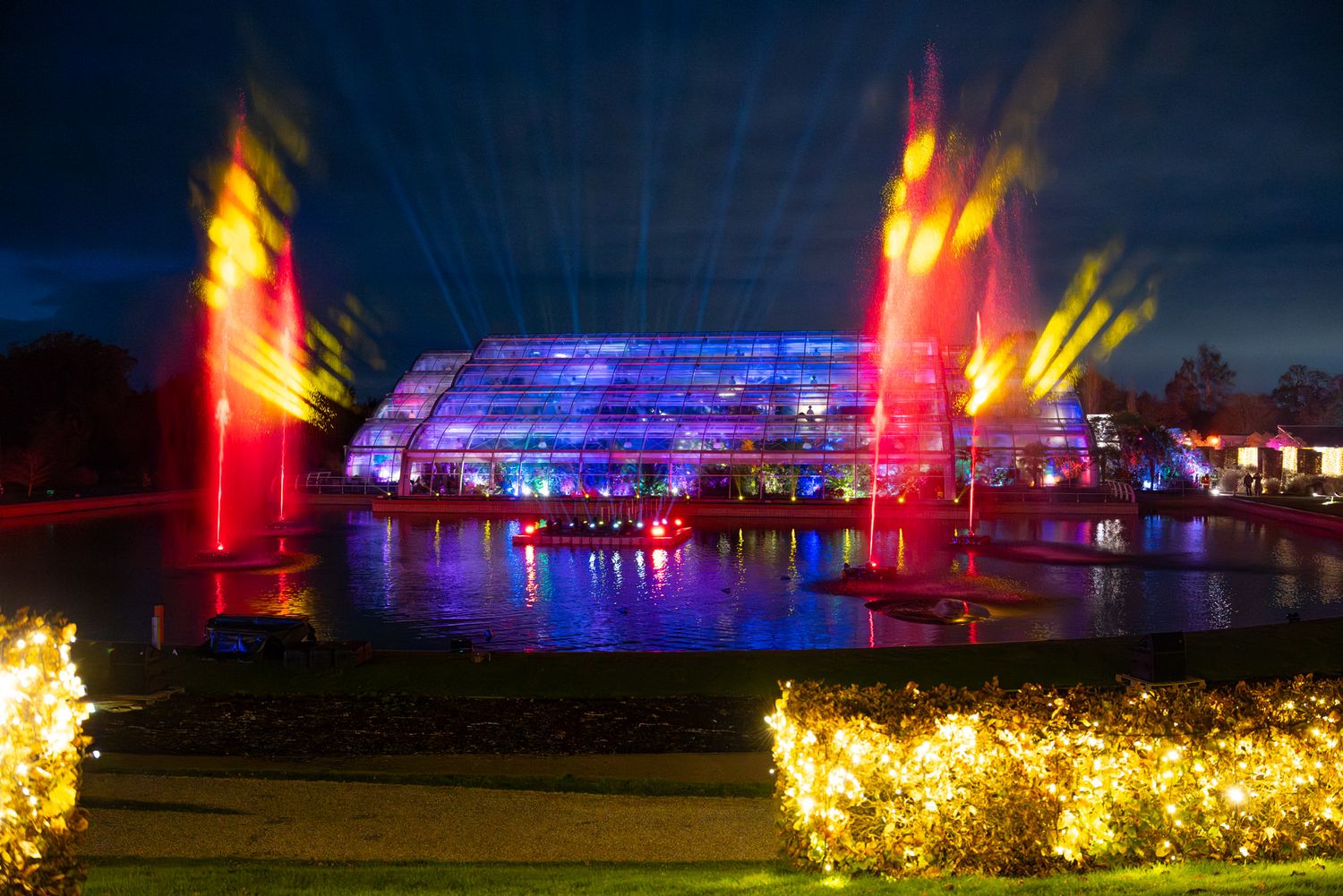
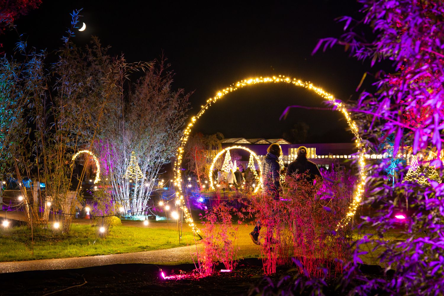
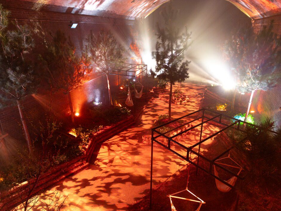
From above, the illuminated routes, trees and installations created patterns that were difficult to appreciate while walking through the gardens. The aerial images showed how the lighting connected different areas and guided visitors through the landscape.
The DJI Mini 3 Pro was the drone used for most of this work. Its compact size made it practical to carry alongside my ground photography equipment and allowed me to switch between aerial and conventional photography during the same assignment.
Low-light drone photography can introduce digital noise, particularly in the darker areas surrounding bright installations. I managed this through careful exposure and then reduced the remaining noise during editing without removing too much natural detail.
You can see a more detailed breakdown of this approach in my article about photographing RHS Glow at Harlow Carr.
Why I combine aerial and ground photography
Drone photography is strongest when it forms part of a wider set of images.
Aerial photographs provide scale, structure and context. Ground-level photographs capture the human experience, planting details, individual displays and atmosphere.
Used together, they can tell a much more complete story:
- The drone establishes the location
- Wide ground photographs show how people experience it
- Medium views document important features
- Details reveal planting, textures and design decisions
- Candid photographs add life and human interest
This approach works well for gardens, events, properties, hotels, estates and other destinations where the surroundings are an important part of the story.
How much does professional drone photography cost?
Standalone drone photography starts from £249 for a straightforward local shoot.
This includes:
- Pre-flight planning and location checks
- Weather and airspace checks
- Up to 45 minutes on location
- Professionally edited aerial photographs
- High-resolution and web-ready files
- Standard website, social media and marketing usage
- Delivery through an online gallery
Drone photography can also be added to an existing ground-level photography booking, provided the aerial work takes place at the same location and can be completed safely.
Larger locations, extended coverage, video, complicated permissions, additional planning or specialist requirements are quoted separately.
All drone photography remains dependent on suitable weather, safe operating conditions, access to the location, and any required permissions.
Do you need drone photography for every project?
No. A drone should only be used when the aerial perspective adds something useful.
For a small, tightly enclosed interior property or event where the surroundings are irrelevant, it may add very little. For gardens, estates, outdoor events, visitor attractions and larger properties, it can completely change how the location is understood.
The question is not simply whether a drone can be flown. It is whether the finished images will communicate something that ground photography cannot.
Drone photography questions
What does drone photography show that ground photography cannot?
Drone photography shows the wider layout, surroundings, scale and relationship between different parts of a location. It is particularly useful for gardens, large properties, outdoor events and visitor attractions.
Can you fly a drone during a public event?
Sometimes, but every location and event must be assessed individually. I usually plan aerial photography for quieter periods, before large visitor numbers arrive or after the public has left.
Can drone photography be completed indoors?
Yes, in some large and controlled spaces. Indoor flights require enough room, a safe flight route and the ability to minimise people and other hazards. They are assessed individually rather than automatically offered for every venue.
What happens if the weather is unsuitable?
High winds, rain or poor visibility may prevent safe flying. Where possible, the aerial photography can be rescheduled or the ground-level part of the assignment can continue without the drone.
Can aerial and ground photography be booked together?
Yes. Combining aerial and ground photography usually creates the strongest set of images because it provides both the wider context and the detailed human perspective.
How much does drone photography cost?
Standalone aerial photography starts from £249. More complex projects are quoted according to the location, required coverage and planning involved.
Professional drone photography for gardens and events
I provide professional aerial and ground-level photography for gardens, visitor attractions, events, properties and tourism clients across Hertfordshire, London and the wider UK.
With more than 16 years of professional photography experience, an A2 Certificate of Competency and appropriate commercial drone insurance, I combine safe flight planning with an experienced photographer’s understanding of composition, light and commercial image use.
View my drone and aerial photography portfolio or get in touch to discuss your project.
About Lee Charlton
Lee Charlton is a Hertfordshire-based commercial photographer with more than 16 years of professional experience. He is A2 CofC-qualified and commercially insured, with extensive experience creating aerial and ground-level photography for gardens, flower shows, visitor attractions, events, property and tourism marketing.